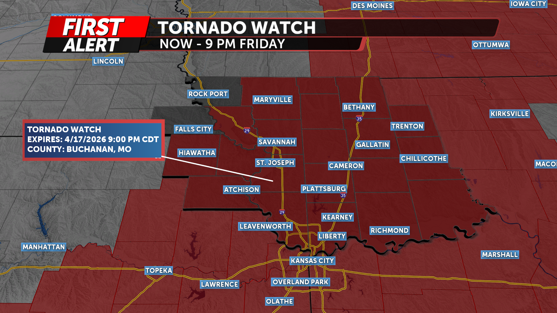
WEATHER ACTION ALERT DAY TODAY: Tornado Watch NOW- 9pm Friday
UPDATE: A Tornado Watch is in effect from NOW - 9 PM FRIDAY
The KQ2 Storm Track Weather Team is issuing a KQ2 Storm Tracker First Alert Weather Day for Friday as the area prepares for strong to severe thunderstorms this afternoon and evening.
In the upper levels of the atmosphere, multiple disturbances will move out of the western United States and into the Plains. This will help strengthen a larger trough and increase lift across the region. At the surface, a cold front will push into northwest Missouri and northeast Kansas later today, interacting with warm, moisture-rich air already in place firing up these thunderstorms.
This setup will create a favorable environment for thunderstorm development by early this afternoon.

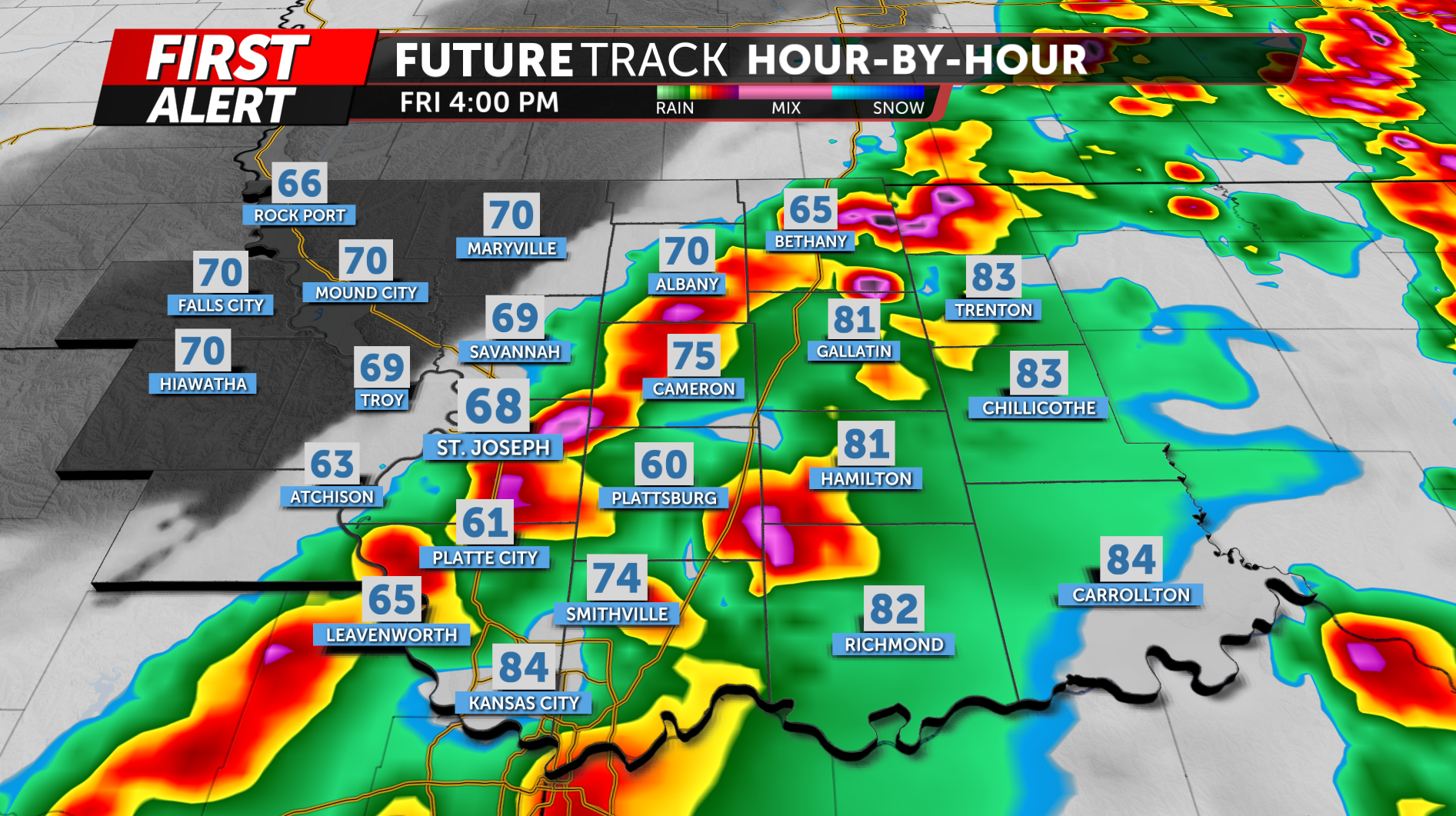
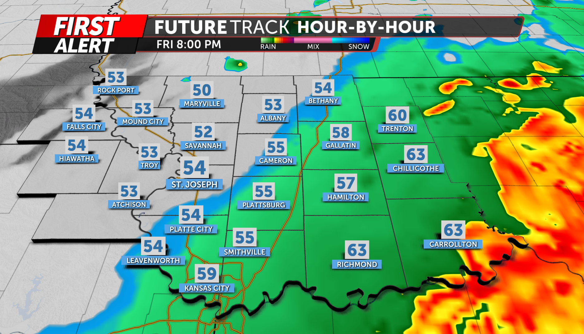
Storms are expected to develop near and just ahead of the cold front, with the initial development beginning around early to mid-afternoon. Given the strong forcing in place, storms should develop quickly and become numerous over a short period of time.
Our area is currently under a Level 2 out of 5 Slight Risk north of Savannah and in far Northwestern Missouri. and South of Savannah and East we are in a Level 2 out of 5 Enhanced risk.
Storms will likely begin as more discrete cells early in the afternoon, which would support a greater risk for large hail. As the evening progresses, storms are expected to quickly organize into clusters and a line along the cold front, shifting the primary threat to damaging wind gusts.
While the tornado threat is not the main concern, an isolated tornado cannot be ruled out, especially if storms are able to remain semi-discrete into the early evening hours.
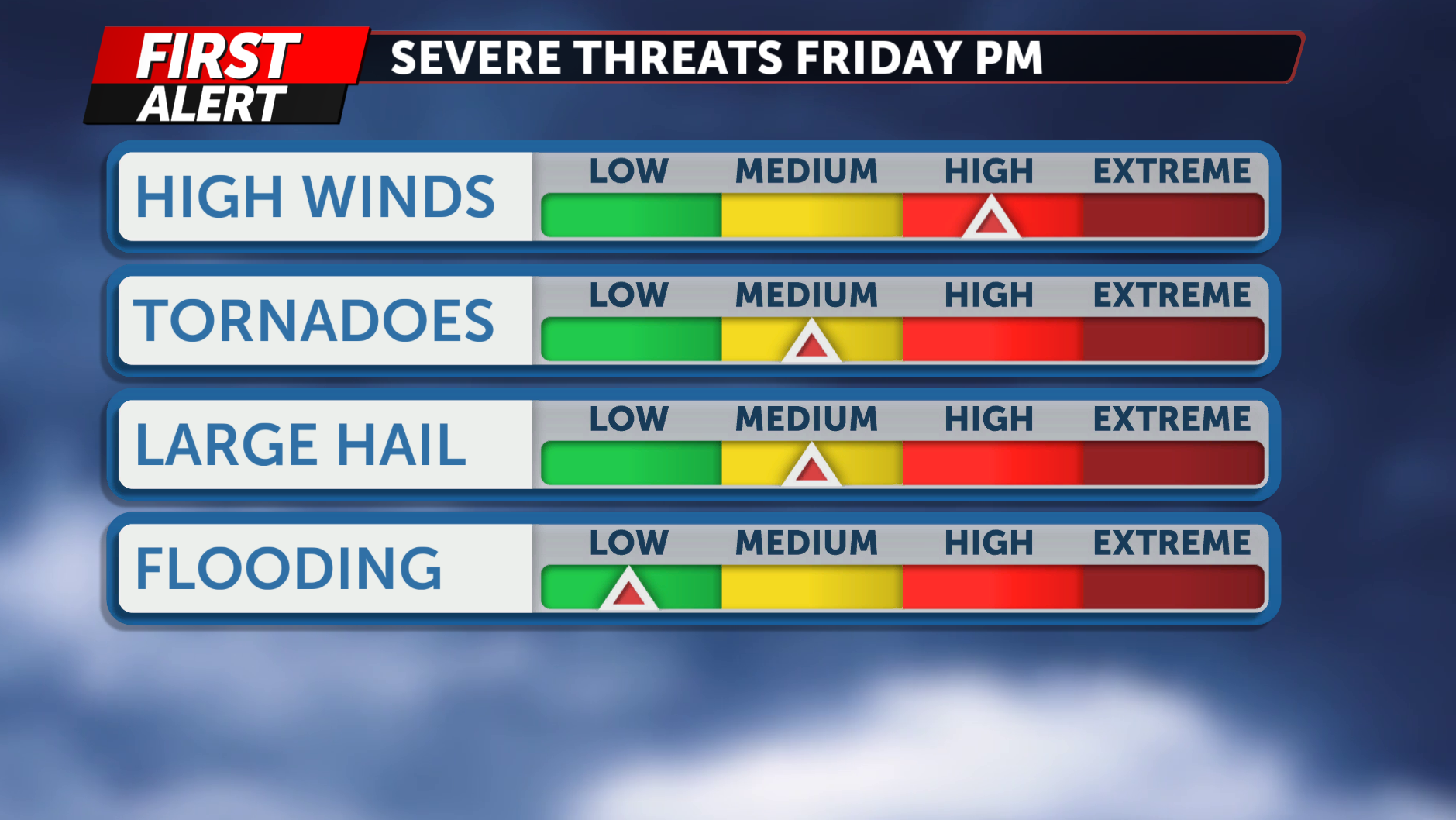
In addition to the severe weather threat, heavy rainfall and flooding will be a growing concern through the evening and overnight hours.
Storms will be capable of producing torrential rainfall, with rates potentially reaching 1 to 2 inches per hour. There is also the potential for training thunderstorms, where multiple storms move over the same areas. This could lead to localized rainfall totals of 2 to 4 inches, especially across areas along and south of the I-70 corridor.
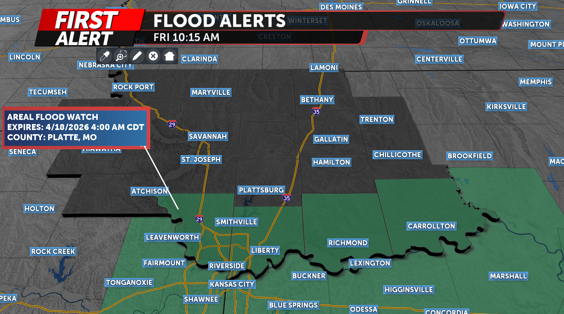
A Flood Watch is in effect for Platte, Clay, and Ray counties in Missouri. This will be in effect late this afternoon through tonight.
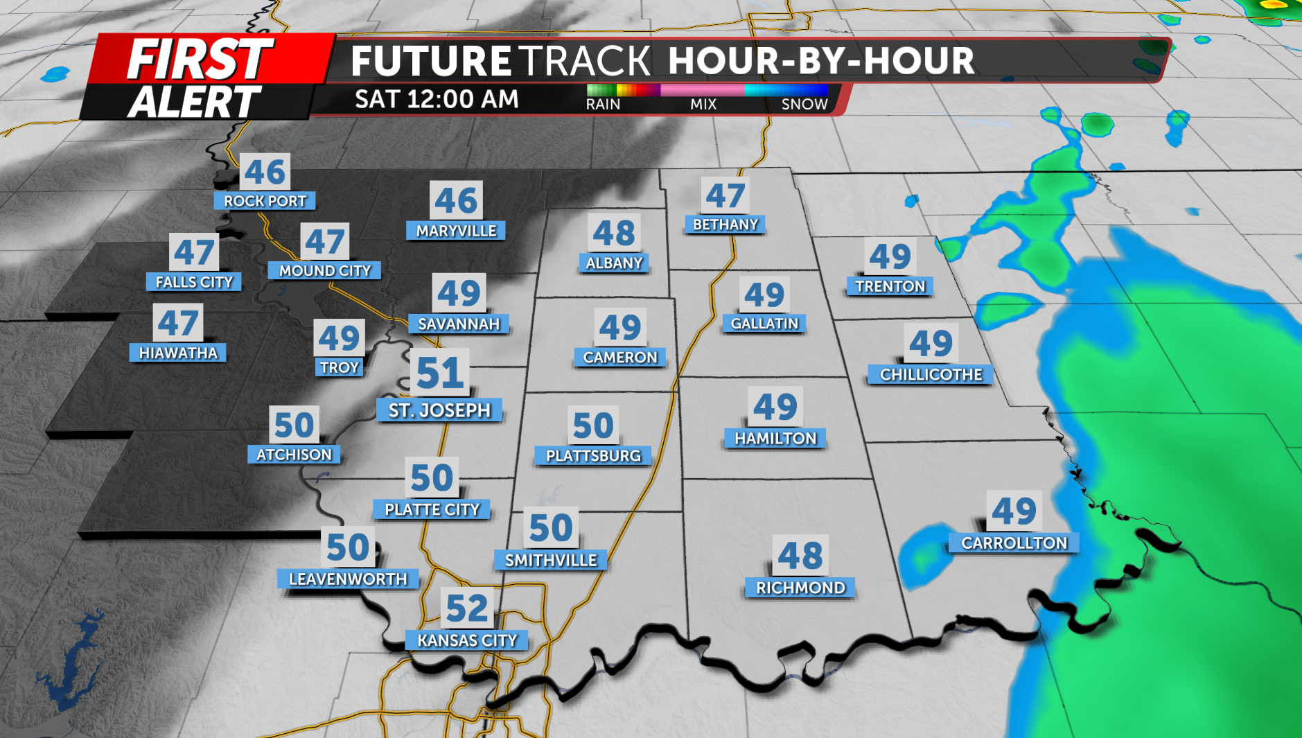
Storms will gradually shift southeast overnight, with the severe threat diminishing by around 10 pm, though periods of heavy rain may linger a bit longer before ending early Saturday morning.
The KQ2 Storm Track Weather Team will continue to closely monitor this developing system and provide updates as the forecast evolves.
Be sure to download the KQ2 Storm Tracker Weather App to receive the latest alerts and forecast updates based on your location.