ACTION ALERT DAY THURSDAY: Tracking strong to severe thunderstorms this evening
The KQ2 Storm Tracker Weather Team is issuing a KQ2 Storm Tracker First Alert Weather Day for Thursday as the area prepares for strong to severe thunderstorms this evening and night.
In the upper levels of the atmosphere, a large trough over the western United States is pushing east into the Plains. A strong jet stream rounding the base of this trough will provide significant lift and wind energy across the region. At the surface, a cold front is moving into the central Plains and will approach Northwest Missouri and Northeast Kansas later this afternoon.
Ahead of this front, warm and moisture-rich air is already in place, with gusty south winds helping to increase humidity and instability. This combination of strong winds aloft, increasing instability, and an approaching front will create a favorable environment for thunderstorm development.
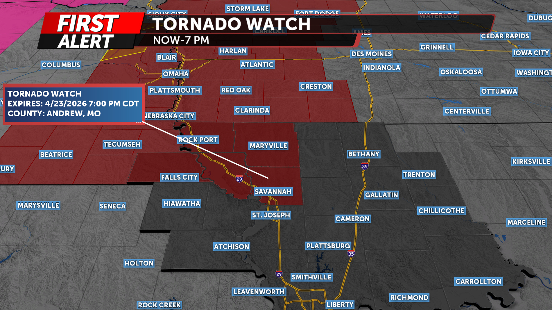
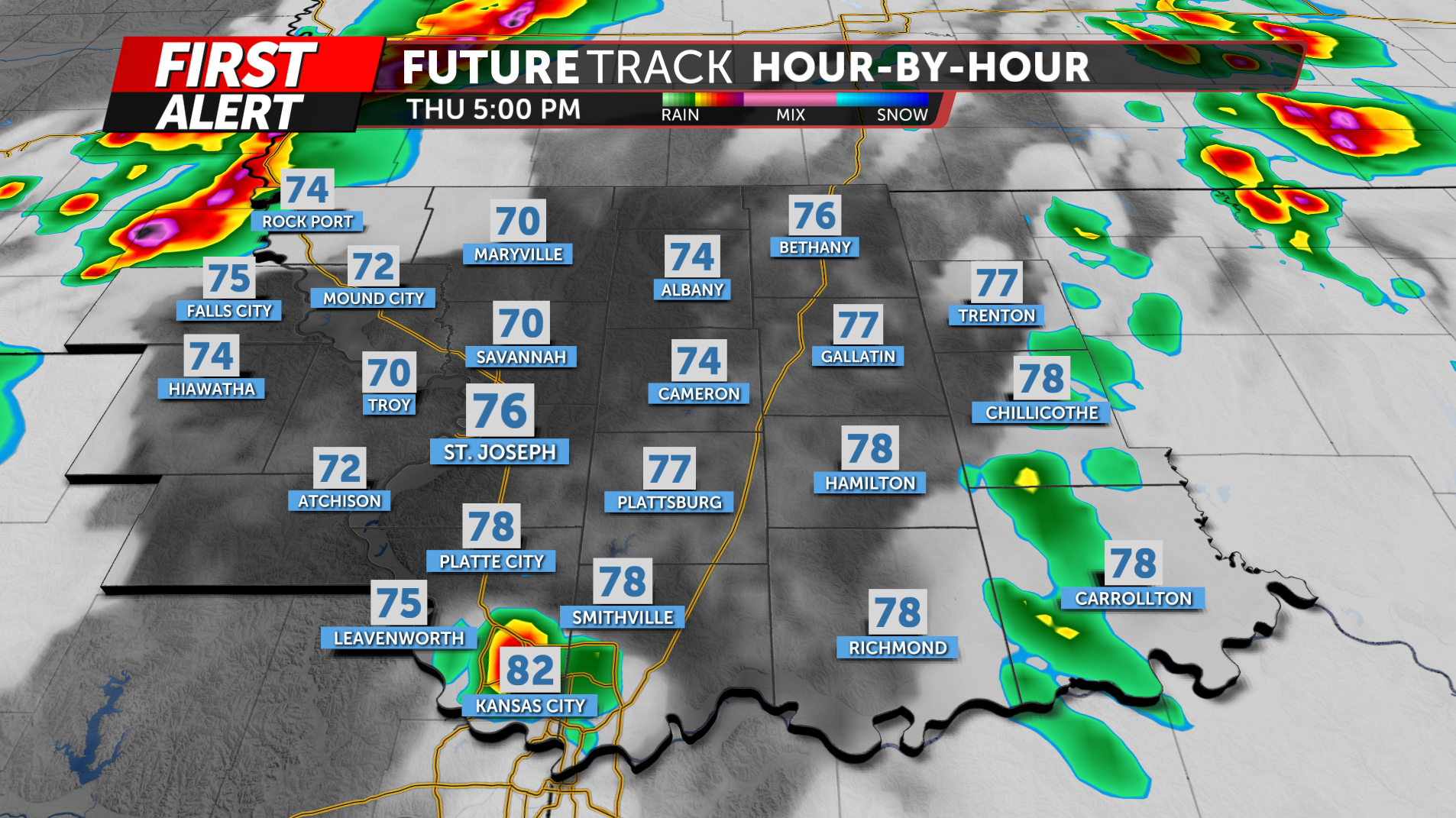
Storms are expected to develop along and just ahead of the cold front by the late afternoon hours, generally after 5 p.m. Initial development is expected across eastern Nebraska into Northeast Kansas and far Northwest Missouri.
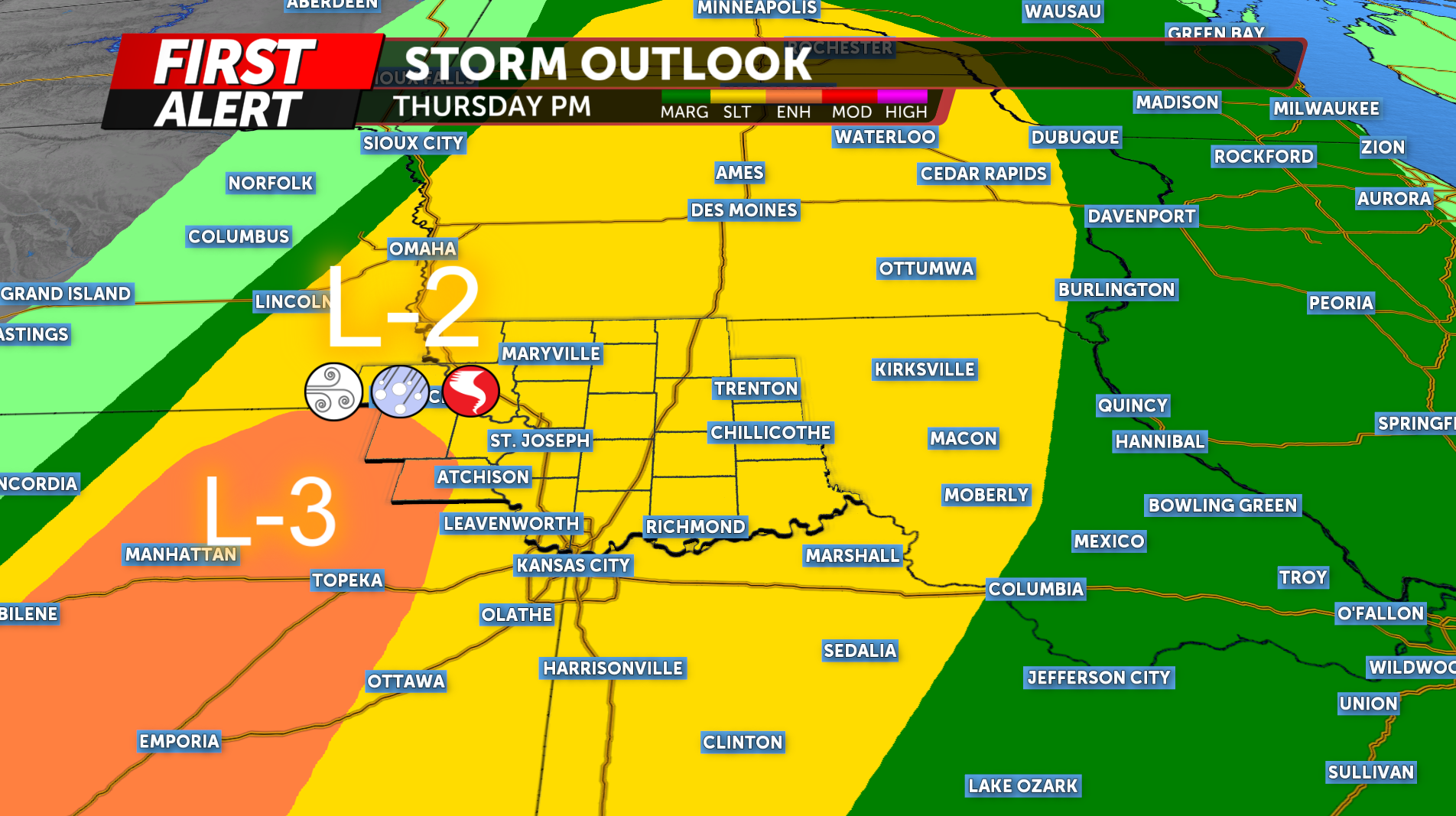
Portions of Northwest Missouri and Northeast Kansas currently under a Level 2 out of 5 Slight Risk for severe weather, with the greatest threat focused across nNortheast Kansas.
Storms will likely begin as discrete supercells, which will support a threat for all severe hazards, including large hail, damaging winds, and a few tornadoes. This will be the timeframe where the tornado risk is highest, especially between roughly 5 and 7 p.m.
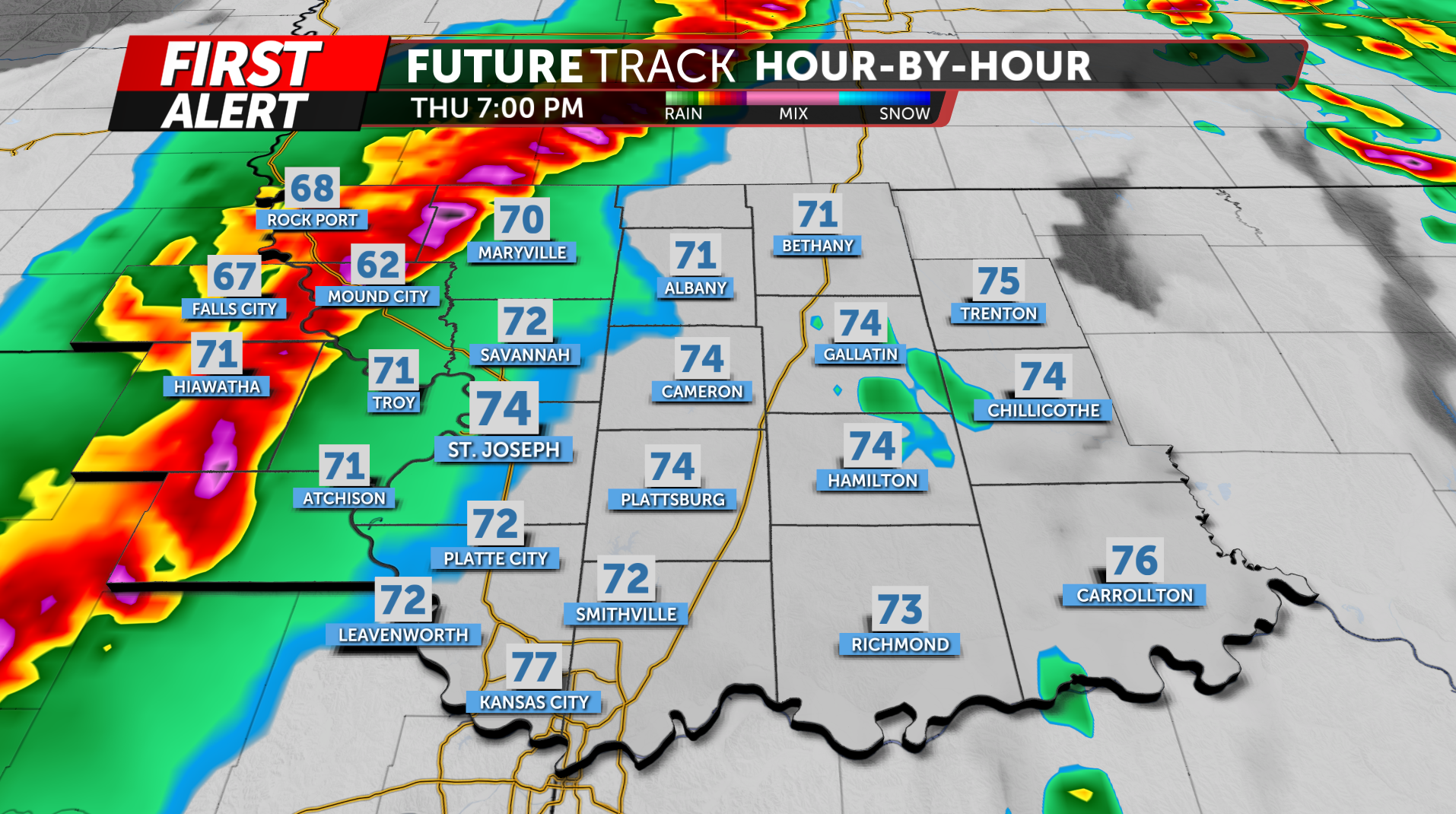
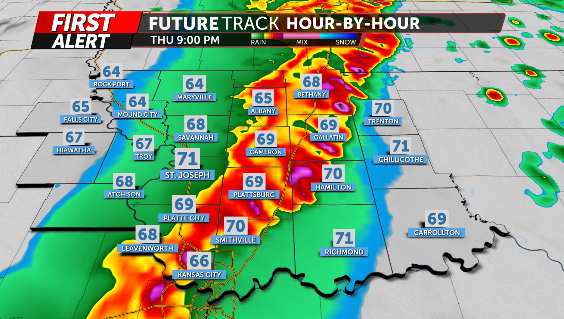
As the evening progresses, storms are expected to quickly organize into a line of thunderstorms along the cold front. As this happens, the primary threat will shift to damaging wind gusts, though brief tornadoes embedded within the line cannot be ruled out.
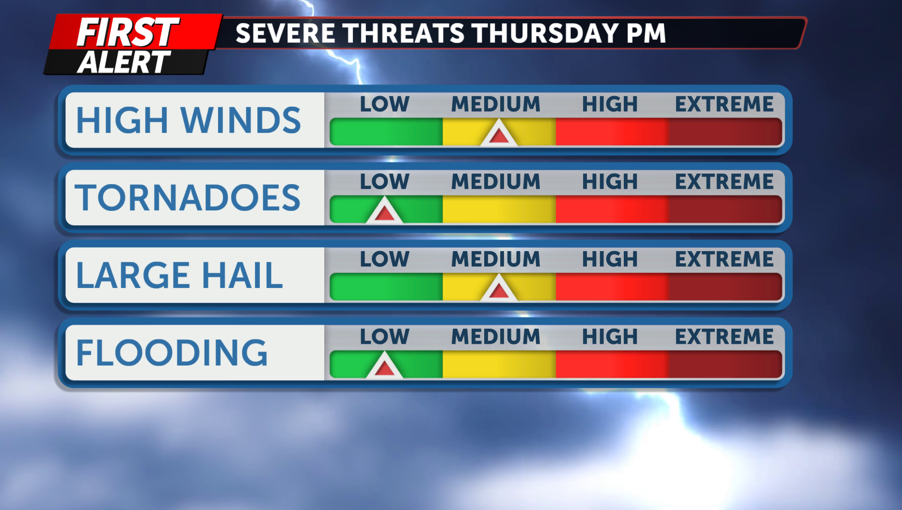
In addition to the severe weather threat, locally heavy rainfall will be possible. However, storms are expected to remain fairly progressive, which should limit the overall flooding risk tonight.
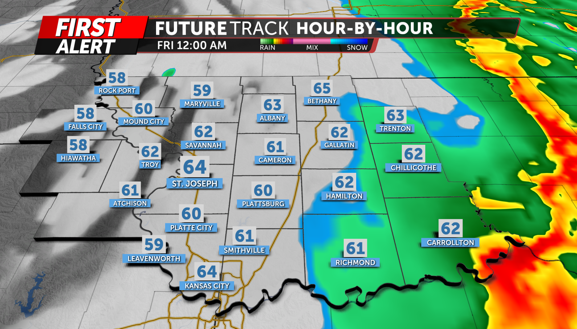
Storms will move from northwest to southeast through the evening and gradually weakening as they push farther east later tonight.
The KQ2 Storm Tracker Weather Team will continue to closely monitor this system and provide updates as conditions evolve.
Be sure to download the KQ2 Storm Tracker Weather App to receive the latest alerts and forecast updates based on your location.