ACTION ALERT DAY TODAY: Tornado Warning issued for NWMO, NEKS regions
The KQ2 Storm Tracker Weather Team has issued an Action Alert Day for Wednesday as the potential for significant severe weather increases across Northwest Missouri and Northeast Kansas this afternoon and evening.
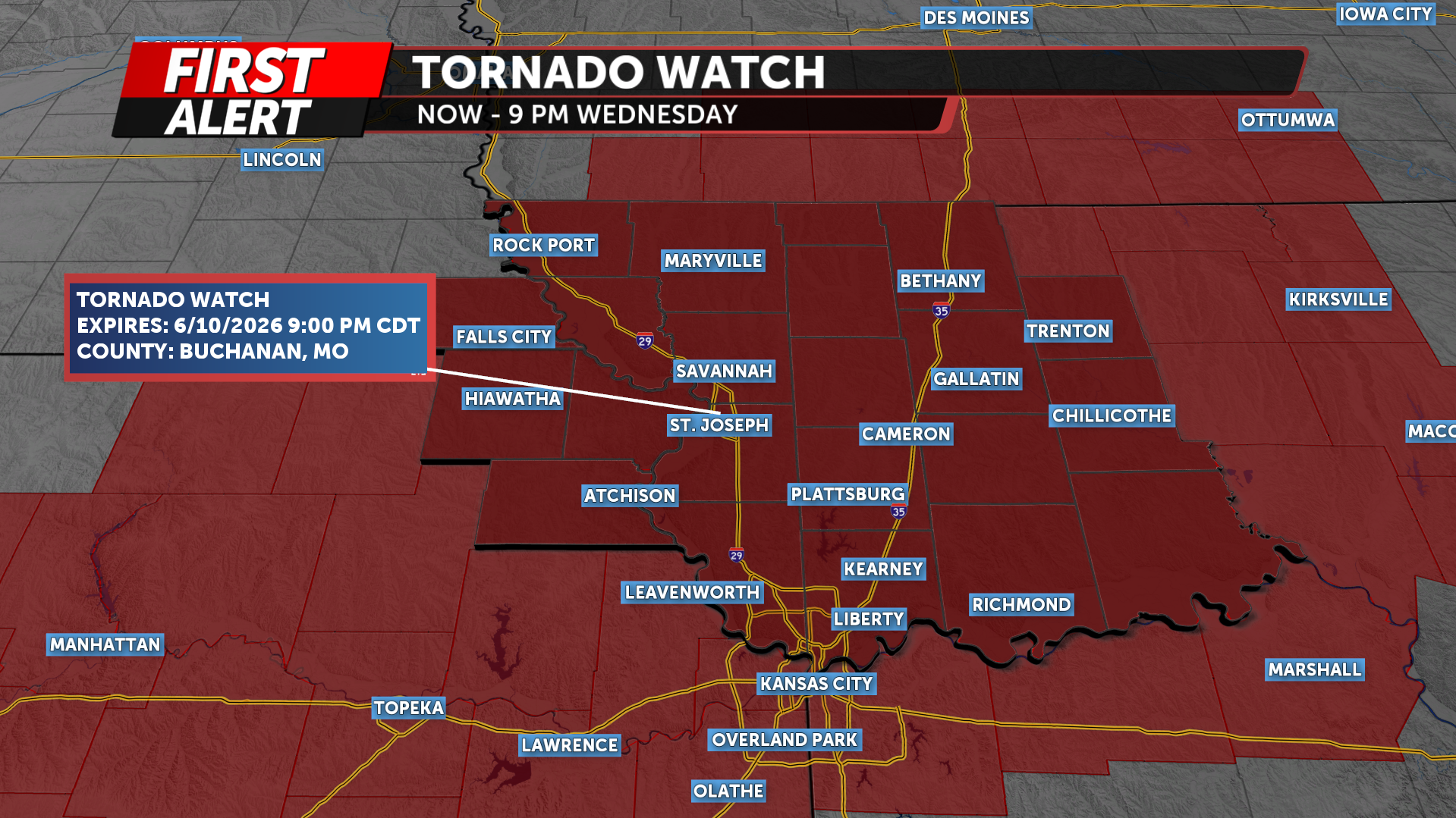
A Tornado Watch has been issued for all of Northwest Missouri and Northeast Kansas through 9 p.m. Wednesday evening.
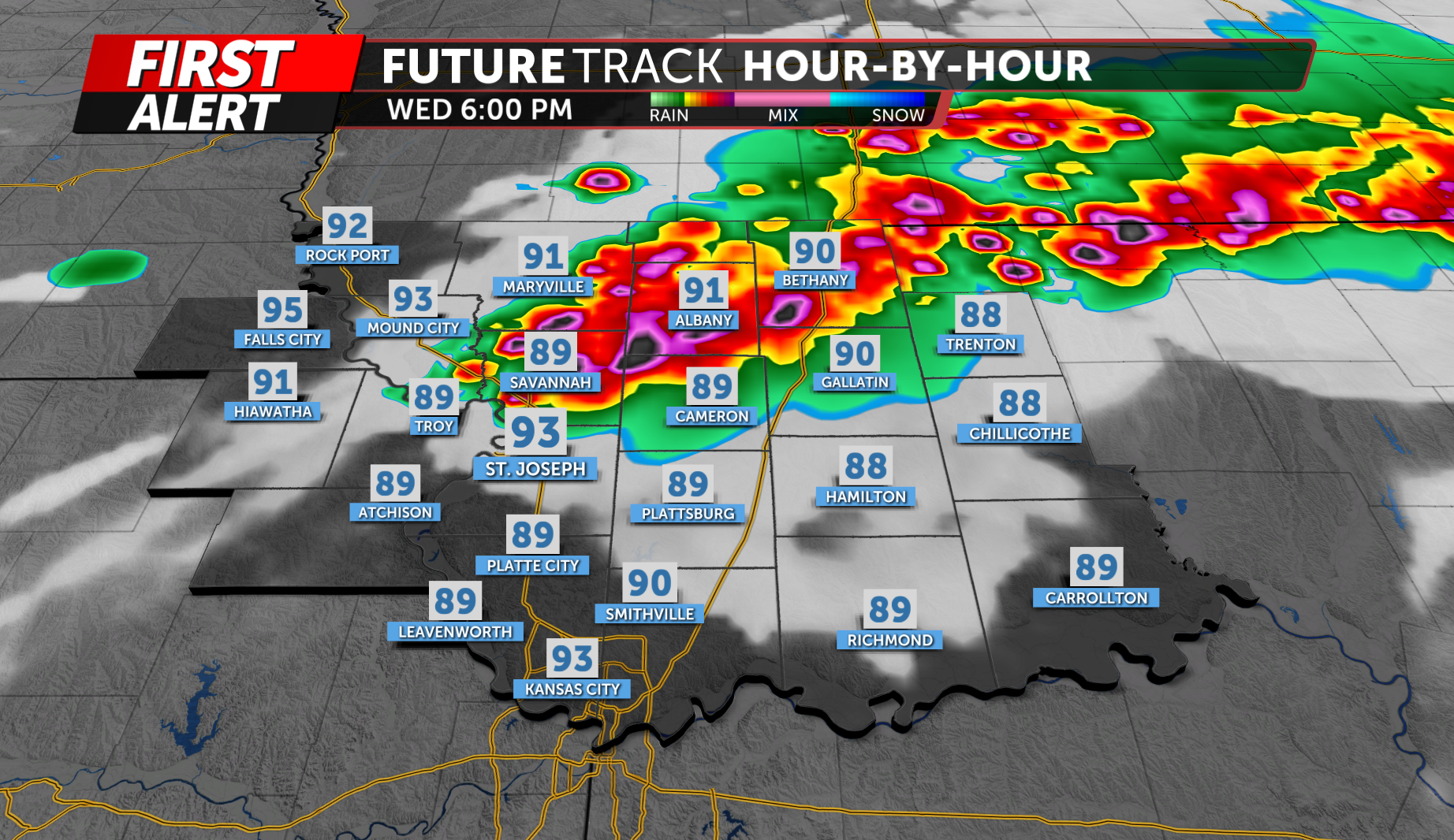
A cold front currently stretching across the Missouri Valley will slowly push southward through the day. Ahead of that front, a hot and very humid air mass remains in place with temperatures climbing into the mid-80s to lower 90s and dew points reaching the mid- to upper 70s.
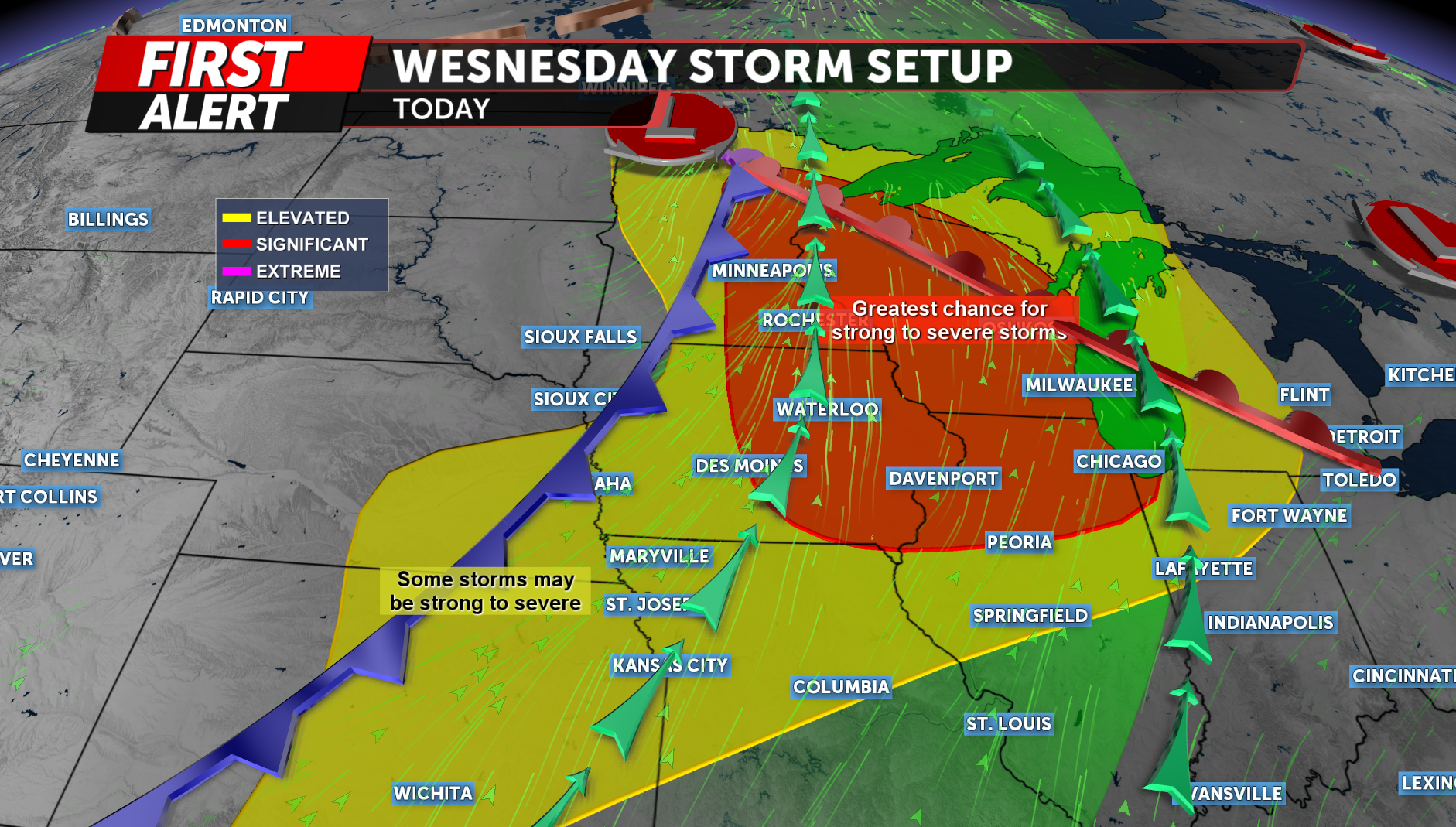
Scattered showers may develop through the morning hours, but the main severe weather threat is expected to begin between 3 and 4 p.m. as thunderstorms rapidly develop along and just ahead of the cold front.
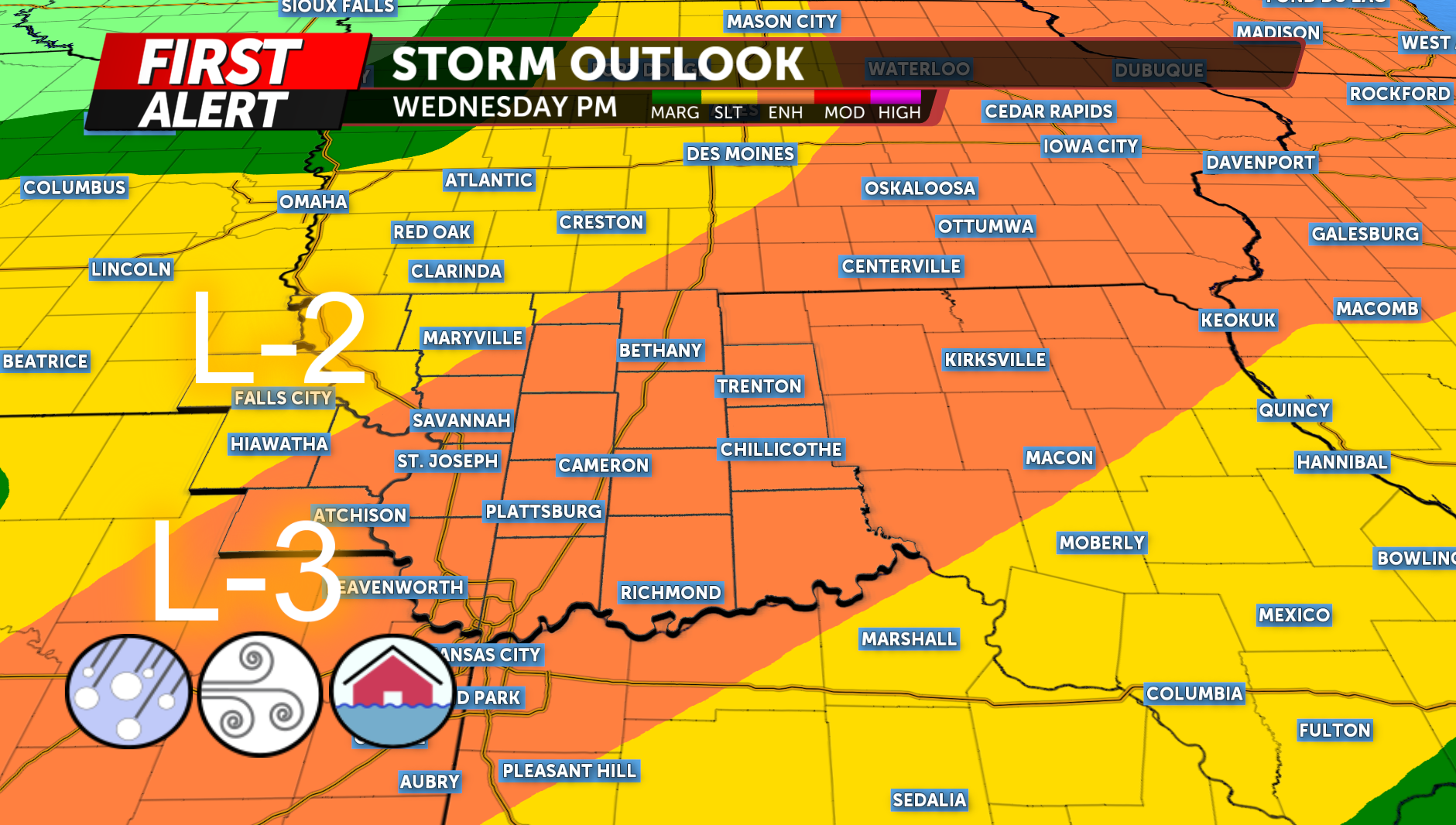
The National Weather Service has placed much of the region under an Enhanced Risk (Level 3 of 5) for severe thunderstorms. Large hail and damaging winds are the primary concerns, but tornadoes and localized flash flooding will also be possible.
Atmospheric conditions will be highly favorable for severe storm development. The combination of extreme instability, moisture and strengthening wind shear will support thunderstorms capable of producing very large hail, damaging straight-line winds and a few tornadoes.
Storms may initially form as isolated supercells during the late afternoon. If storms remain separate for an extended period of time, hail larger than 2 inches in diameter will be possible. However, storms will quickly organize into a broken line or clusters during the evening hours.
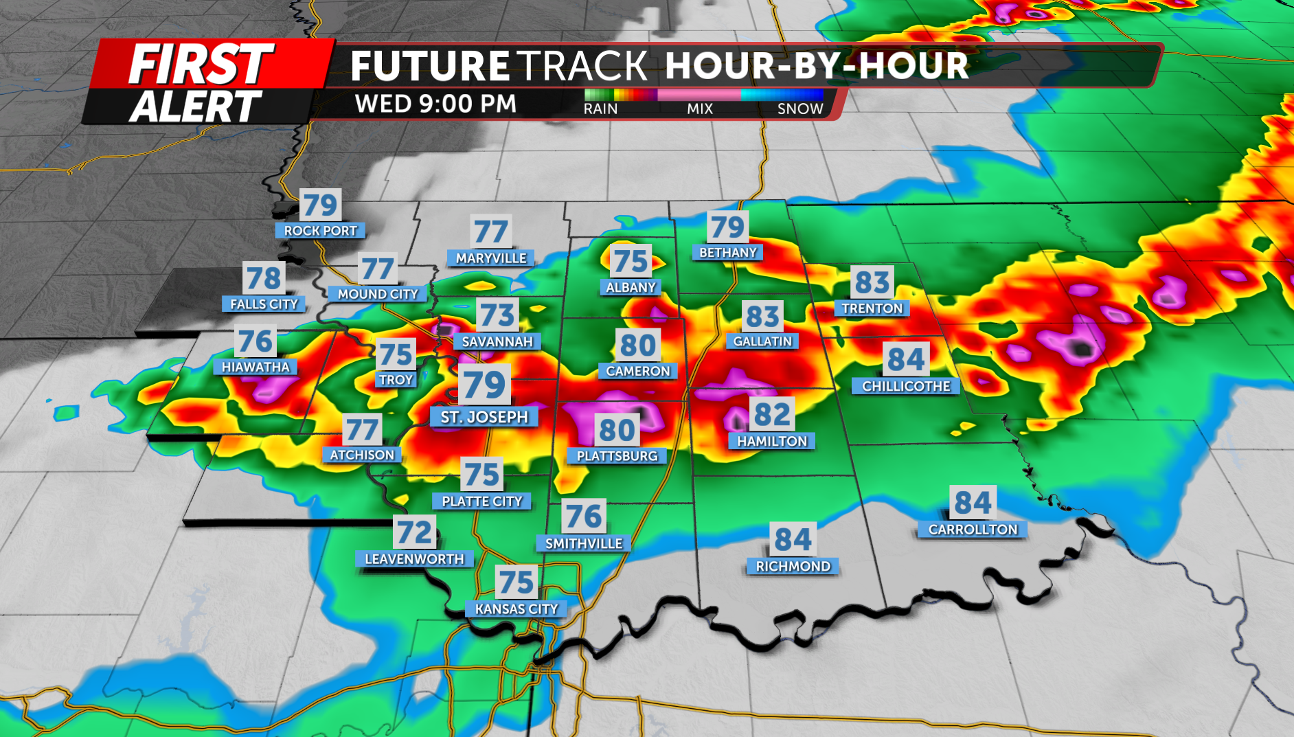
As storms evolve into a line, the threat will transition toward widespread damaging wind gusts. Some wind gusts could exceed 75 mph. Brief tornadoes will remain possible within any bowing segments or stronger circulations embedded within the line.

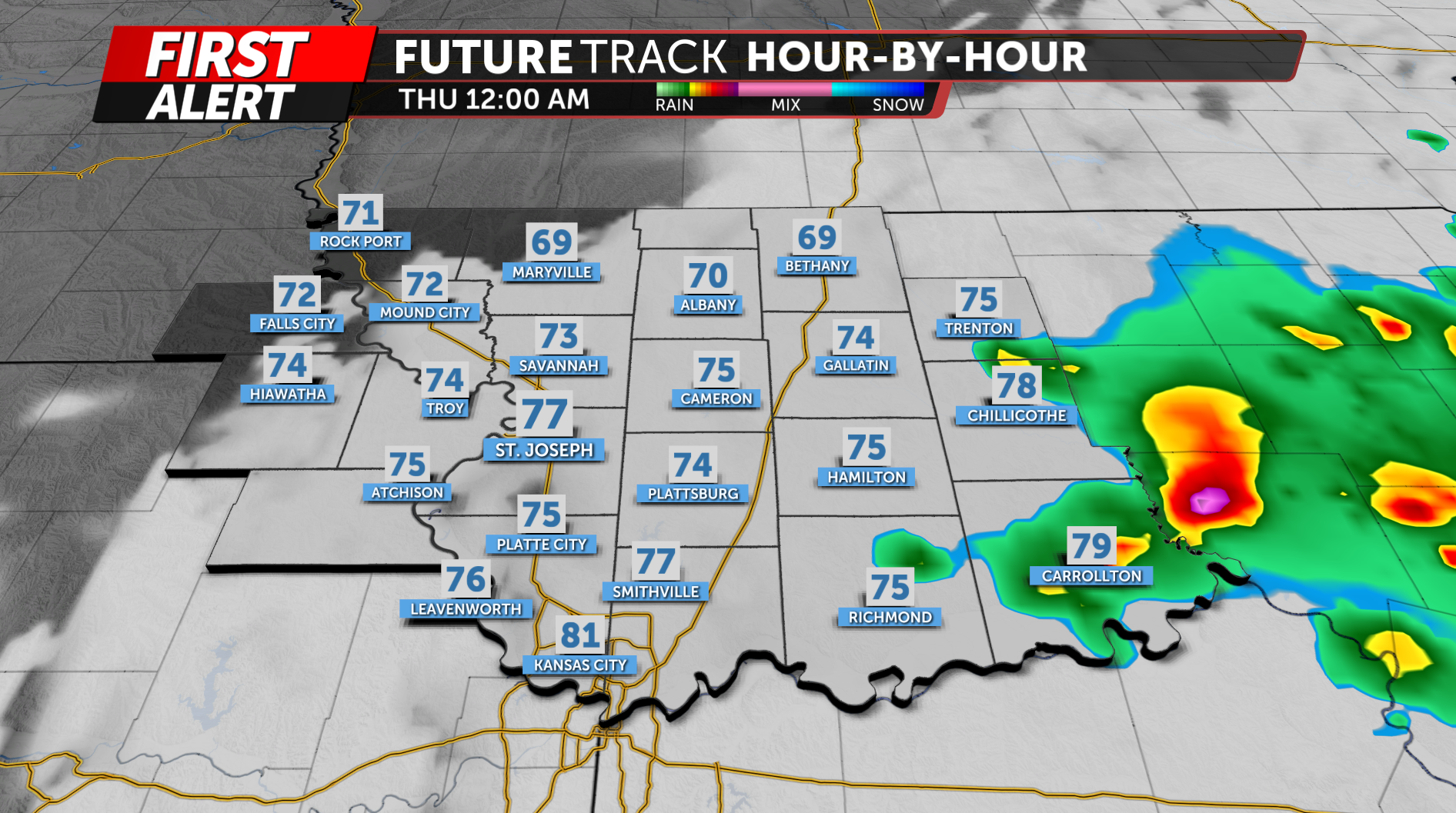
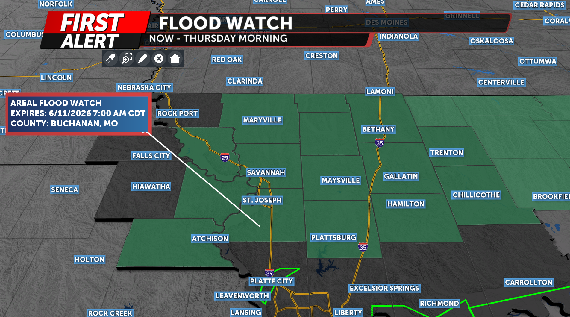
In addition to the severe weather threat, heavy rainfall could lead to localized flooding concerns. The atmosphere contains nearly 2 inches of precipitable water, indicating storms will be efficient rainfall producers. While storms are expected to remain progressive, any locations experiencing repeated rounds of thunderstorms could see rapid water accumulation and isolated flash flooding.
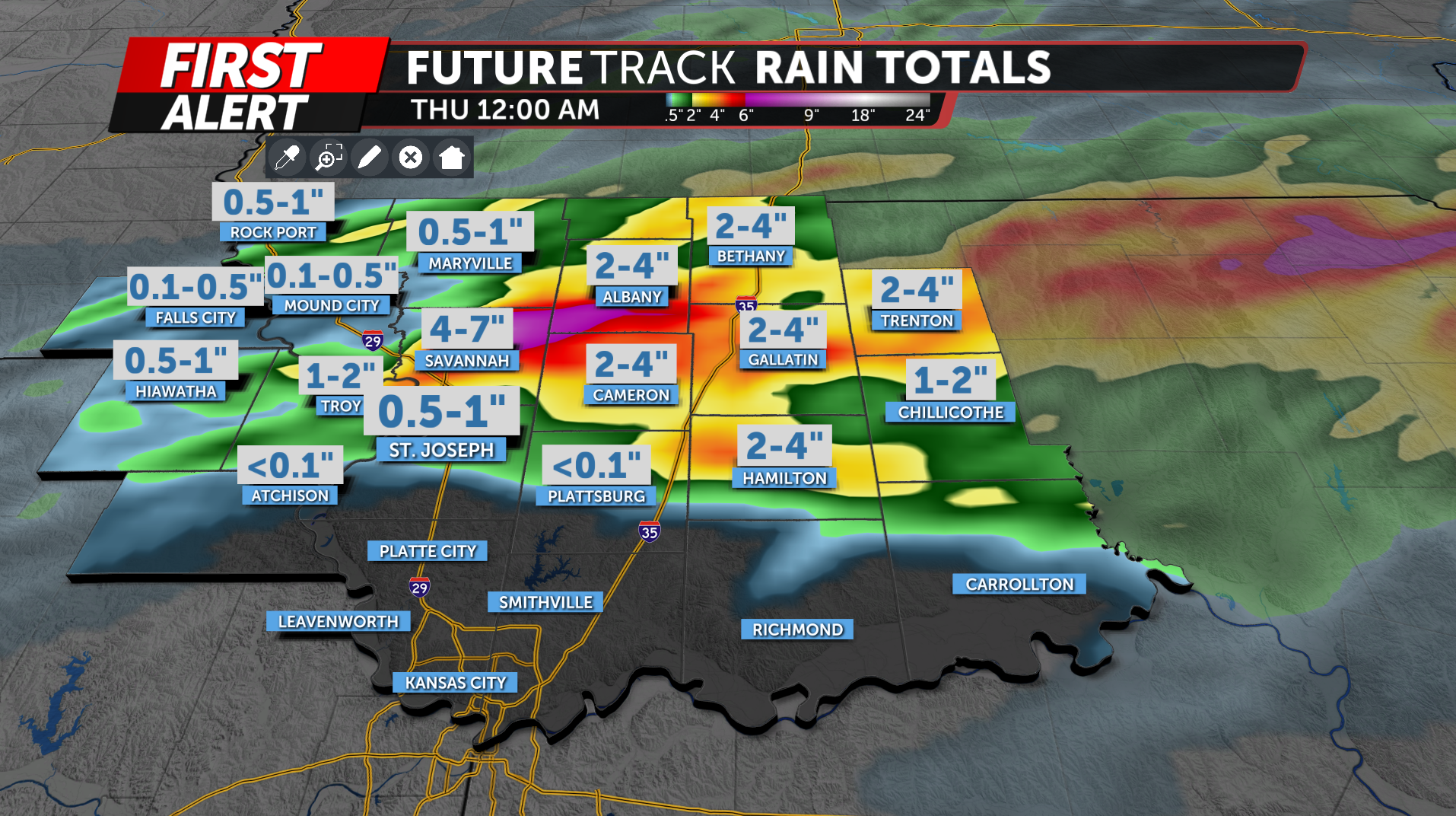
Due to this concern an areal flood watch has been issues until Thursday morning for portion of the viewing area along 36 hwy.
The KQ2 Storm Tracker Weather Team will continue to monitor today's severe weather threat and provide updates on-air, online and through social media as conditions evolve.
Be sure to download the KQ2 Storm Tracker Weather App to receive watches, warnings and customized alerts for your location.
