WEATHER ALERT DAY: Tracking possible severe thunderstorms Friday evening
The KQ2 Storm Track Weather Team is issuing a KQ2 Storm Tracker First Alert Weather Day for Friday as the area prepares for the potential for severe thunderstorms Friday afternoon and evening.
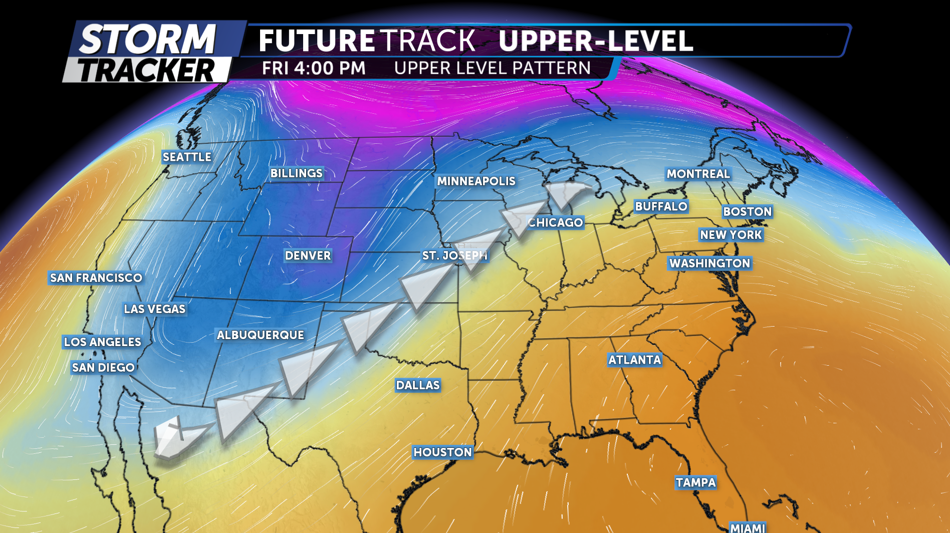
In the upper levels of the atmosphere, a large trough of low pressure will deepen across the Desert Southwest. This system will help drive a surge of warm, moisture-rich air north into northwest Missouri and northeast Kansas ahead of an approaching cold front.
The first round of storms is expected to develop late Thursday night into early Friday morning. These storms will form as a warm front lifts north through the region and a strong low-level jet brings additional moisture into the area.
A few storms could be strong, especially across far northwest Missouri, producing gusty winds, small hail and pockets of heavy rainfall.
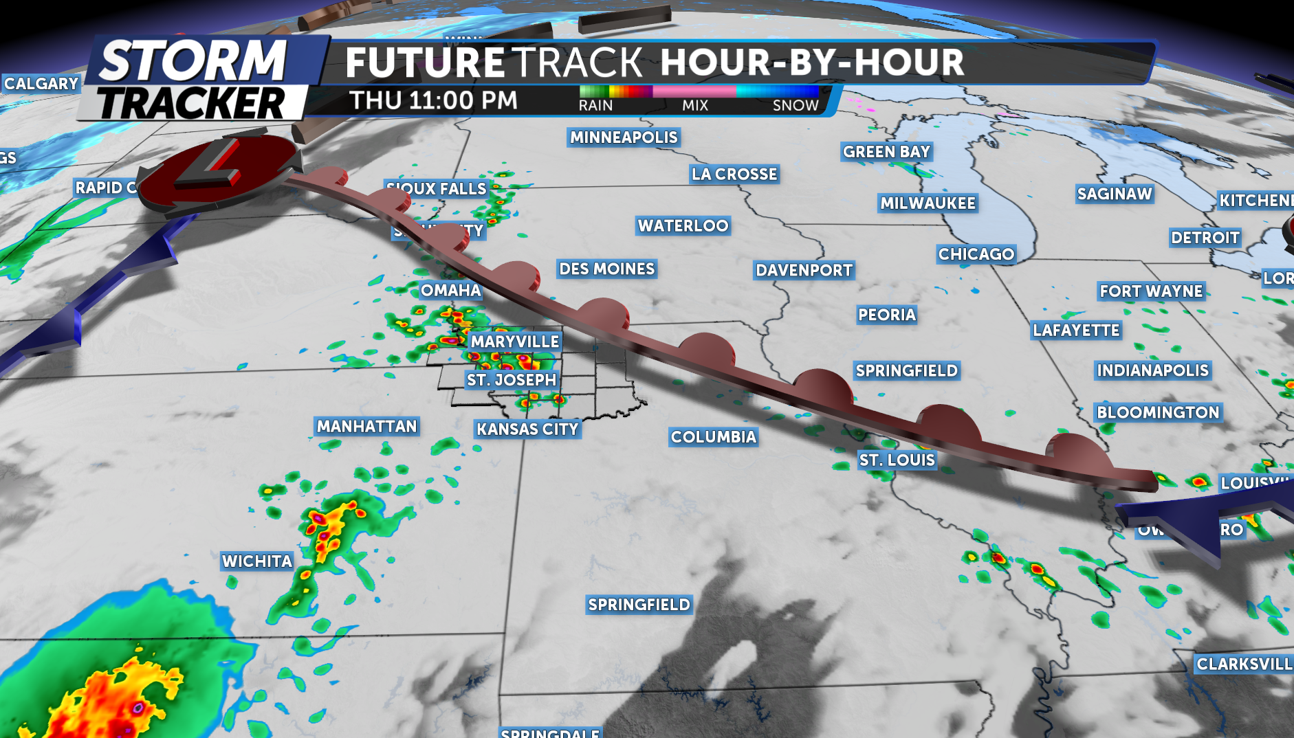
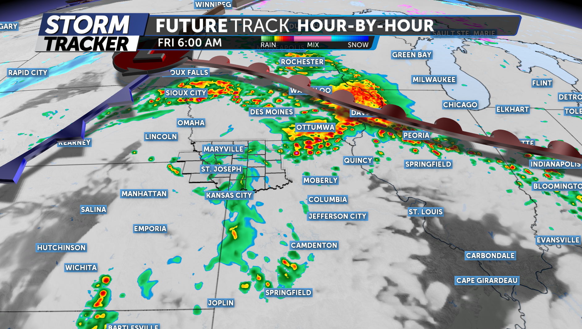
Additional showers and thunderstorms may continue into Friday morning, which could leave behind cloud cover and lingering rain. How these early storms perform will have a major impact on the severe weather potential later in the day.
If clouds and rain linger into the afternoon, they could limit instability. However, if skies partially clear and temperatures warm into the 70s, the atmosphere could become more favorable for stronger storms.
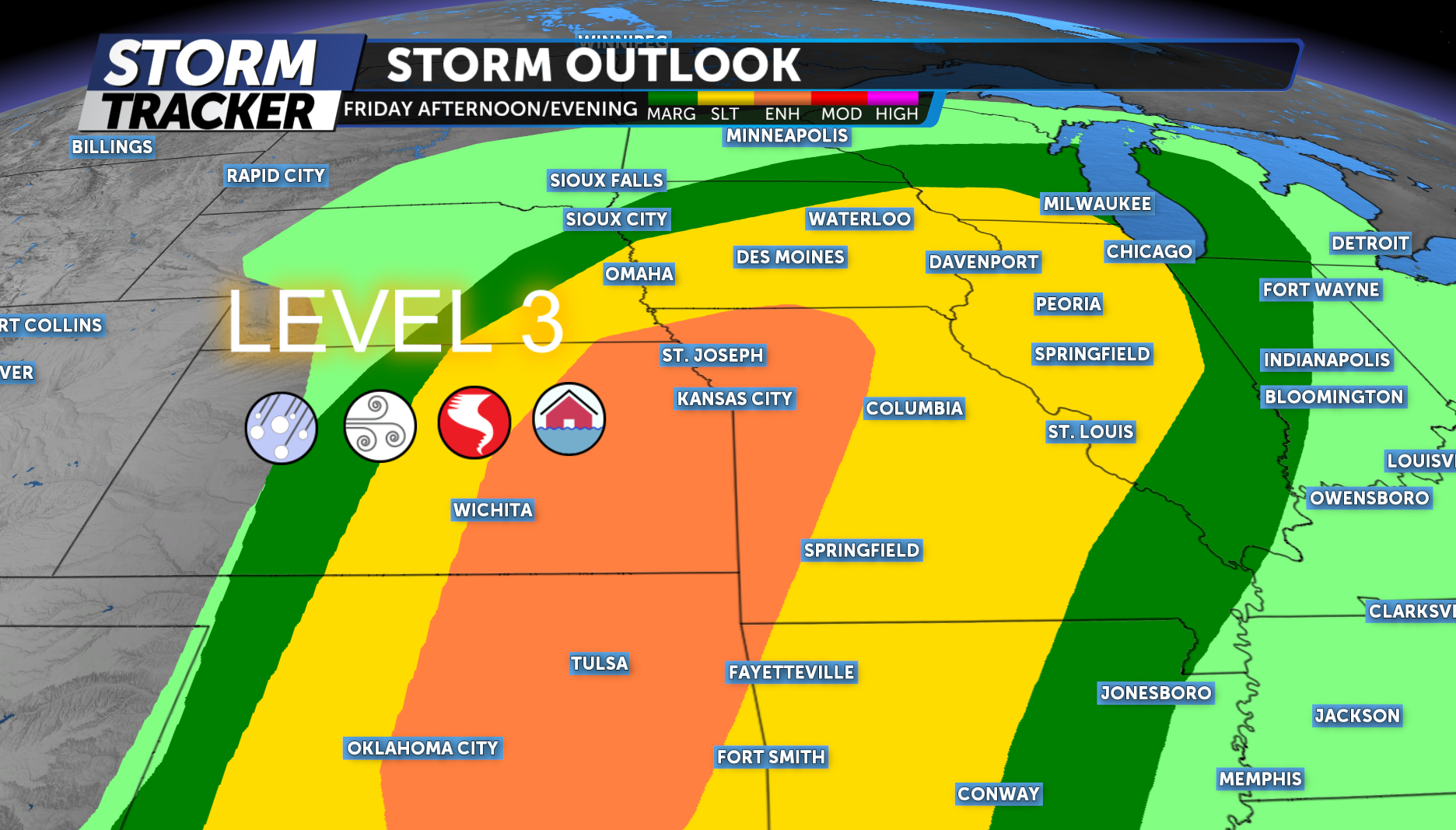
For Friday afternoon and evening, our area is currently under a Level 3 out of 5 Enhanced Risk for severe weather.
All severe hazards are possible, including heavy rainfall, damaging wind gusts, large hail and an iIsolated tornado.
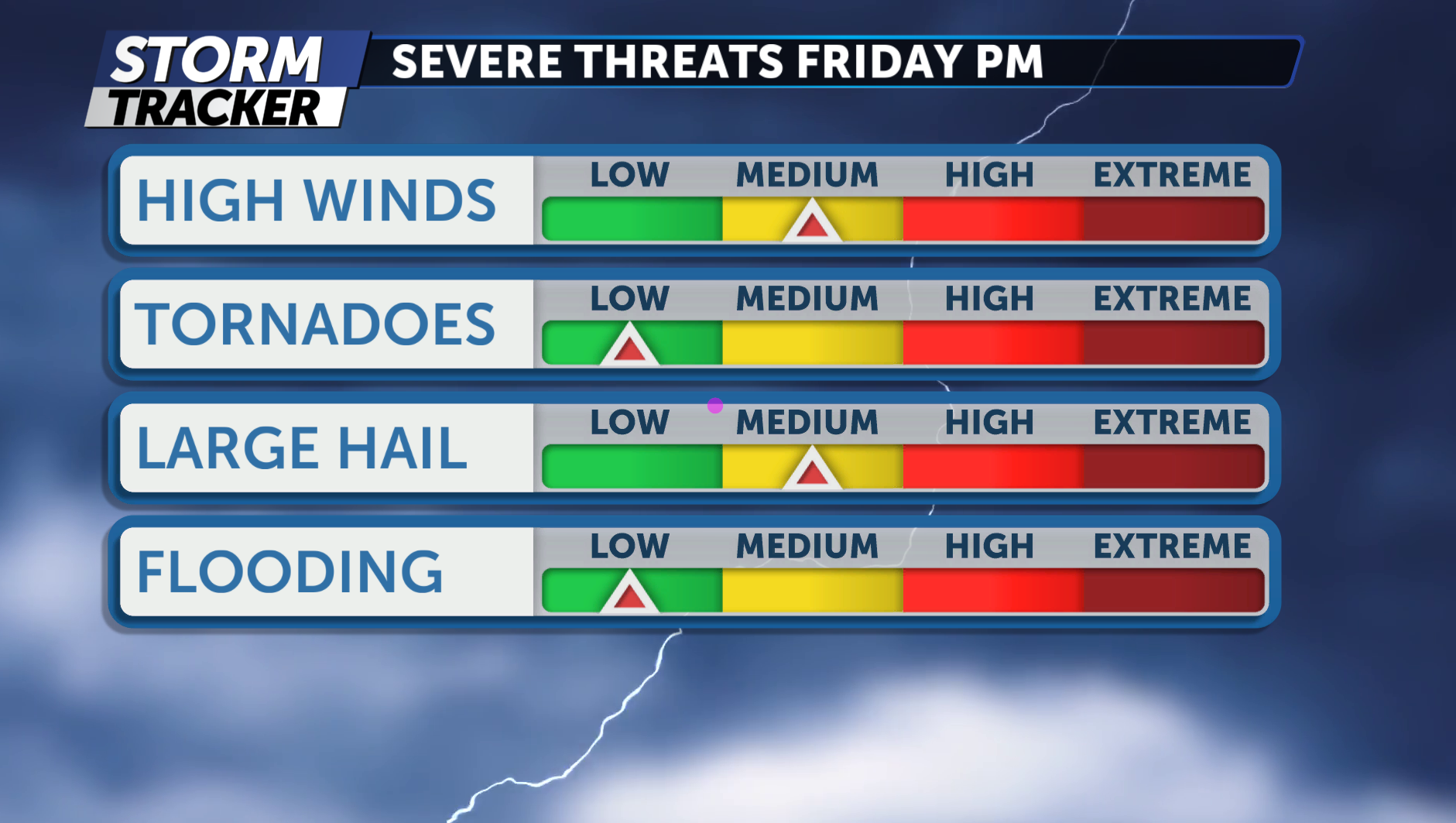
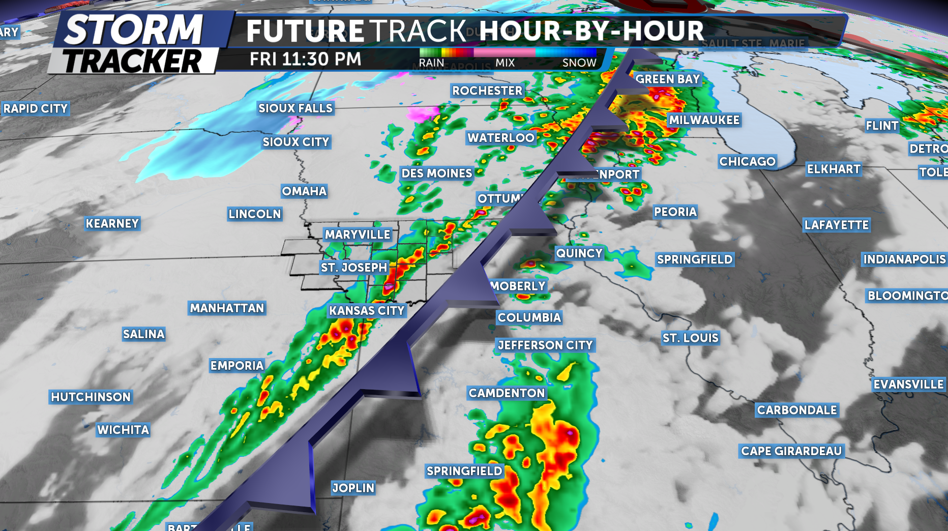
Storm timing may come in two waves Friday evening. The first round could develop during the late afternoon and evening commute, as isolated thunderstorms form ahead of the approaching cold front. Some of these storms could become strong to severe and may develop into discrete supercells capable of producing large hail, damaging winds and possibly a tornado.
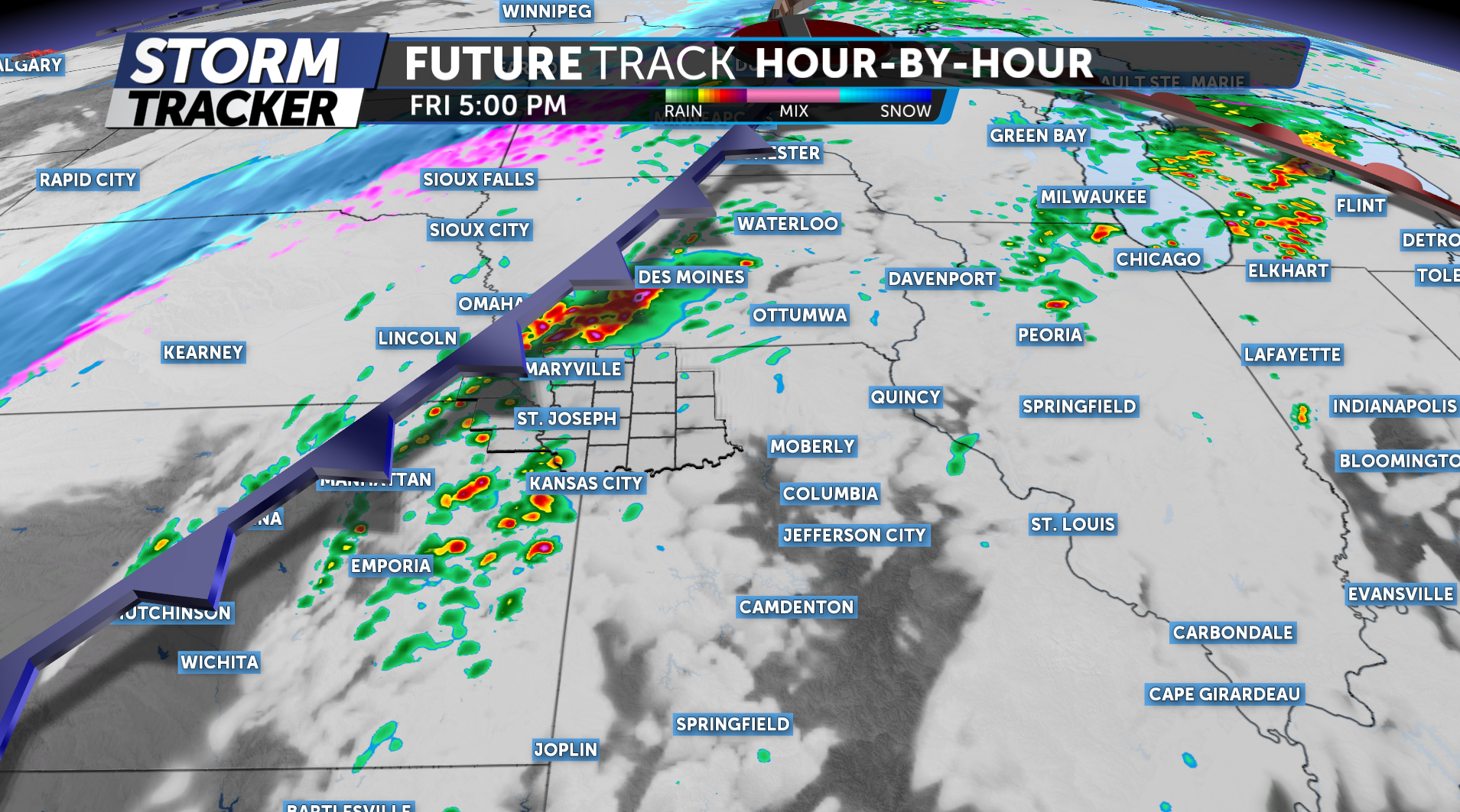
The second round is expected later Friday evening into the overnight hours, when storms may organize into a line of thunderstorms along the cold front. This line could bring strong wind gusts, heavy rain and the potential for embedded tornadoes as it moves through the region.
The KQ2 Storm Track Weather Team will continue to closely monitor this developing system and provide updates as the forecast evolves.
Be sure to download the KQ2 Storm Tracker Weather App to receive the latest alerts and forecast updates based on your location.