ACTION ALERT DAY TODAY: Strong storms this evening all hazards possible
The KQ2 Storm Tracker Weather Team has issued a KQ2 Storm Tracker Action Alert Weather Day for Northwest Missouri and Northeast Kansas ahead of strong to severe thunderstorms Monday evening into early Tuesday morning.
A strong upper-level trough currently lifting out of the Four Corners region will track across the Central Plains today. At the surface, a stalled to slowly moving frontal boundary remains draped across eastern Kansas into northwest Missouri and Iowa. Ahead of this boundary, very warm, moist, and increasingly unstable air will build through the afternoon, creating a highly favorable environment for severe thunderstorm development.
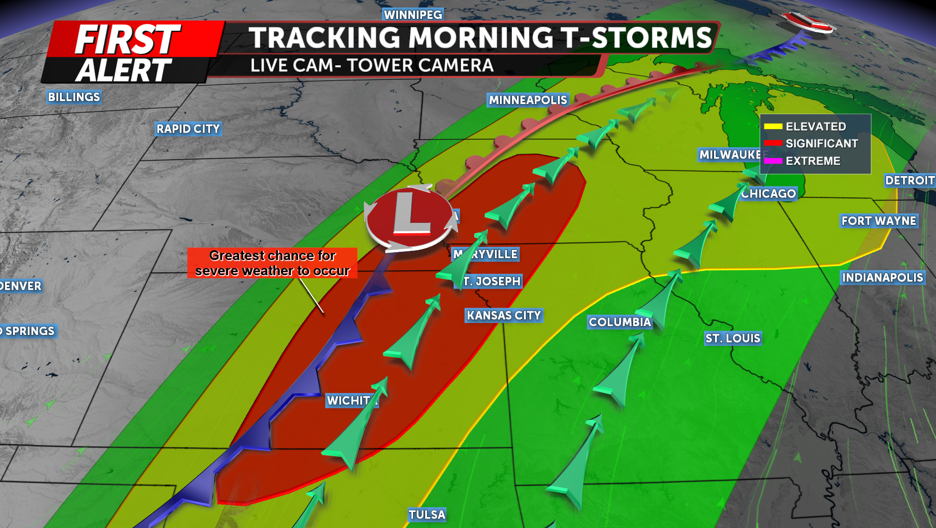
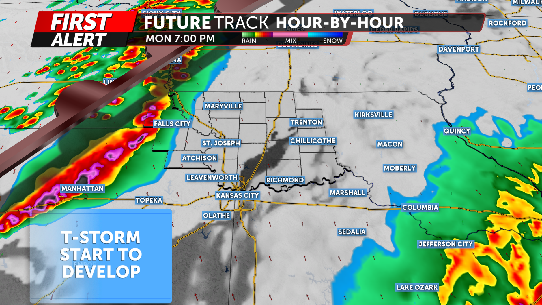
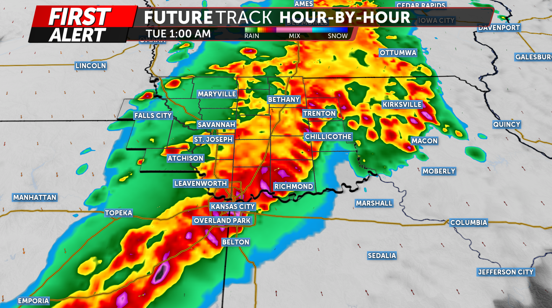
Thunderstorms are expected to initiate along and just ahead of this boundary by late afternoon into early evening, generally across eastern Nebraska, northeast Kansas, and far northwest Missouri. Early storm development may remain discrete at first, especially during the late afternoon and early evening hours.
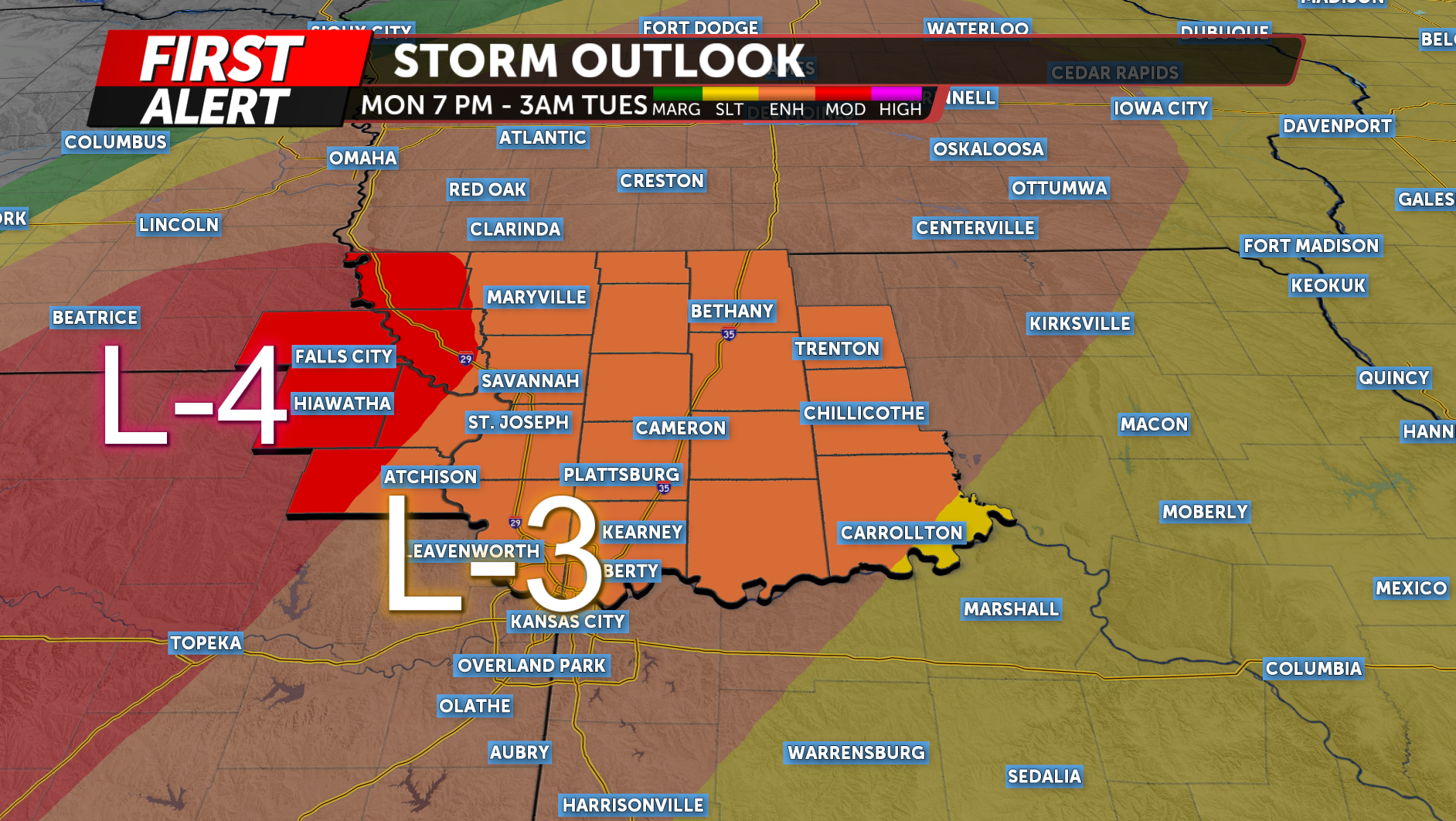
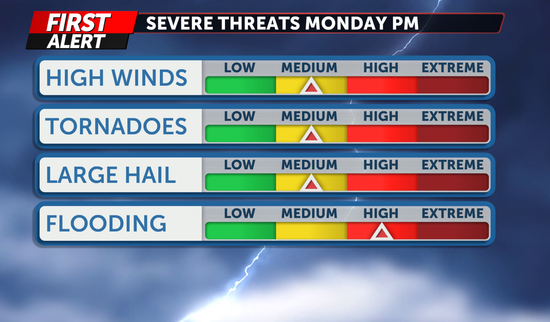
Portions of Northwest Missouri and Northeast Kansas are under an elevated severe weather threat this evening. A Moderate Risk (Level 4/5) is in place for portions of northeast Kansas and northwest Missouri, including Hiawatha, Holt County, and Atchison County. An Enhanced Risk (Level 3/5) covers the rest of the viewing area.
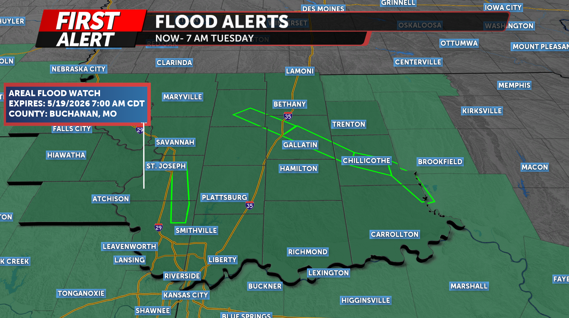
All severe hazards are possible, including damaging winds, a few strong tornadoes, large hail, and localized flash flooding. We are already seeing flooding north of the area near Trenton in Grundy County, and additional rainfall is expected through the day.
An Areal Flood Watch remains in effect from this morning through Tuesday morning due to the potential for additional heavy rainfall. Flood warnings are also ongoing for portions of the Grand, Thompson, and Platte River basins.
As the evening progresses, storms are expected to rapidly organize into a line of thunderstorms (a squall line) moving east-southeast across northwest Missouri. Once this occurs, the primary threat will shift to damaging straight-line winds. However, brief embedded tornadoes (QLCS spin-ups) will remain possible, especially with bowing segments and strong low-level wind shear.
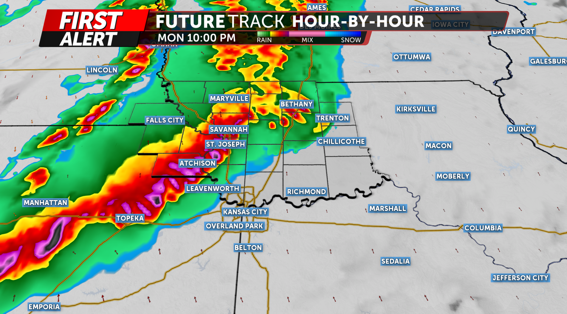
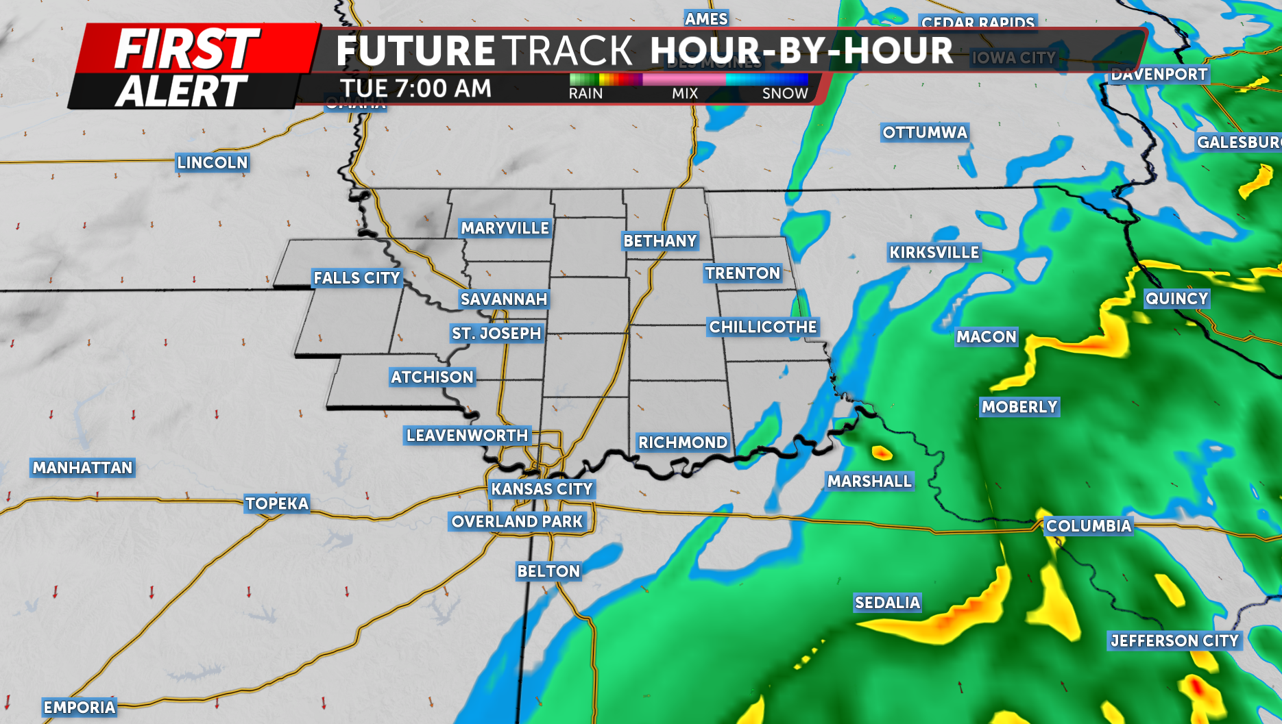
Storms will continue southeast through the overnight hours and gradually weaken as they exit the region late tonight into early Tuesday.
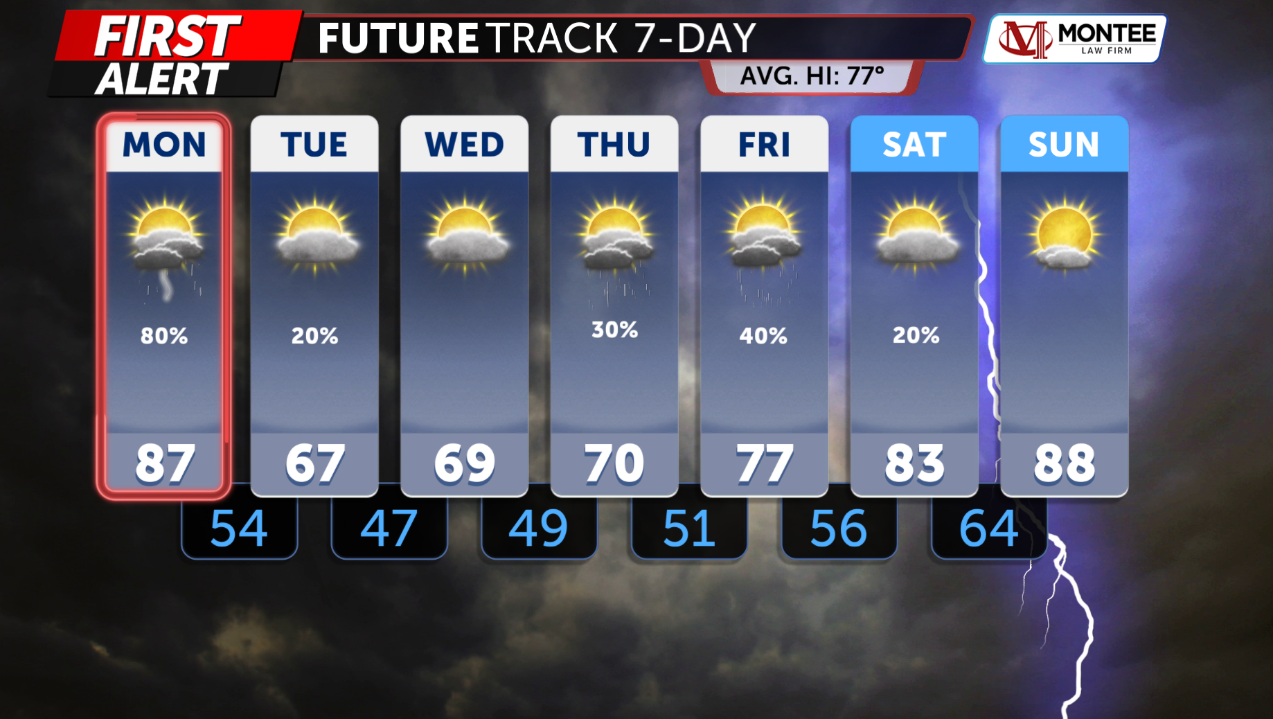
Behind this system, much cooler and more comfortable air arrives Tuesday through Thursday, with highs mainly in the 60s and lower humidity before temperatures warm again heading into the weekend.
The KQ2 Storm Tracker Weather Team will continue to closely monitor this evolving severe weather situation and provide updates as conditions change throughout the day.
Be sure to download the KQ2 Storm Tracker Weather App for the latest alerts tailored to your location.