ACTION ALERT WEATHER DAY: Severe threat Friday evening
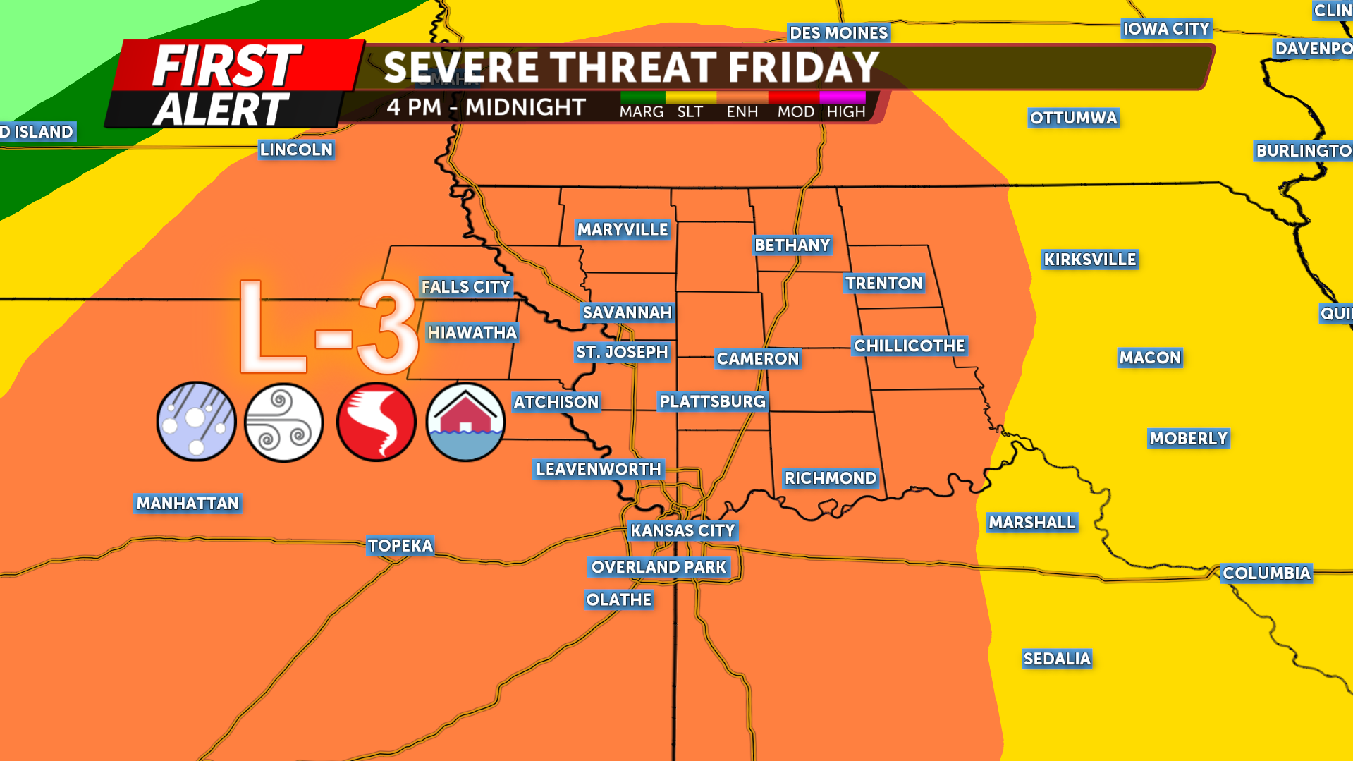
Today is a KQ2 Storm Tracker Action Alert Day as a threat for strong to severe thunderstorms develops across Northwest Missouri and Northeast Kansas late Friday afternoon and evening. Storms capable of producing large hail, damaging winds, and a few tornadoes will be possible, mainly from after 4 PM continuing as late as midnight.
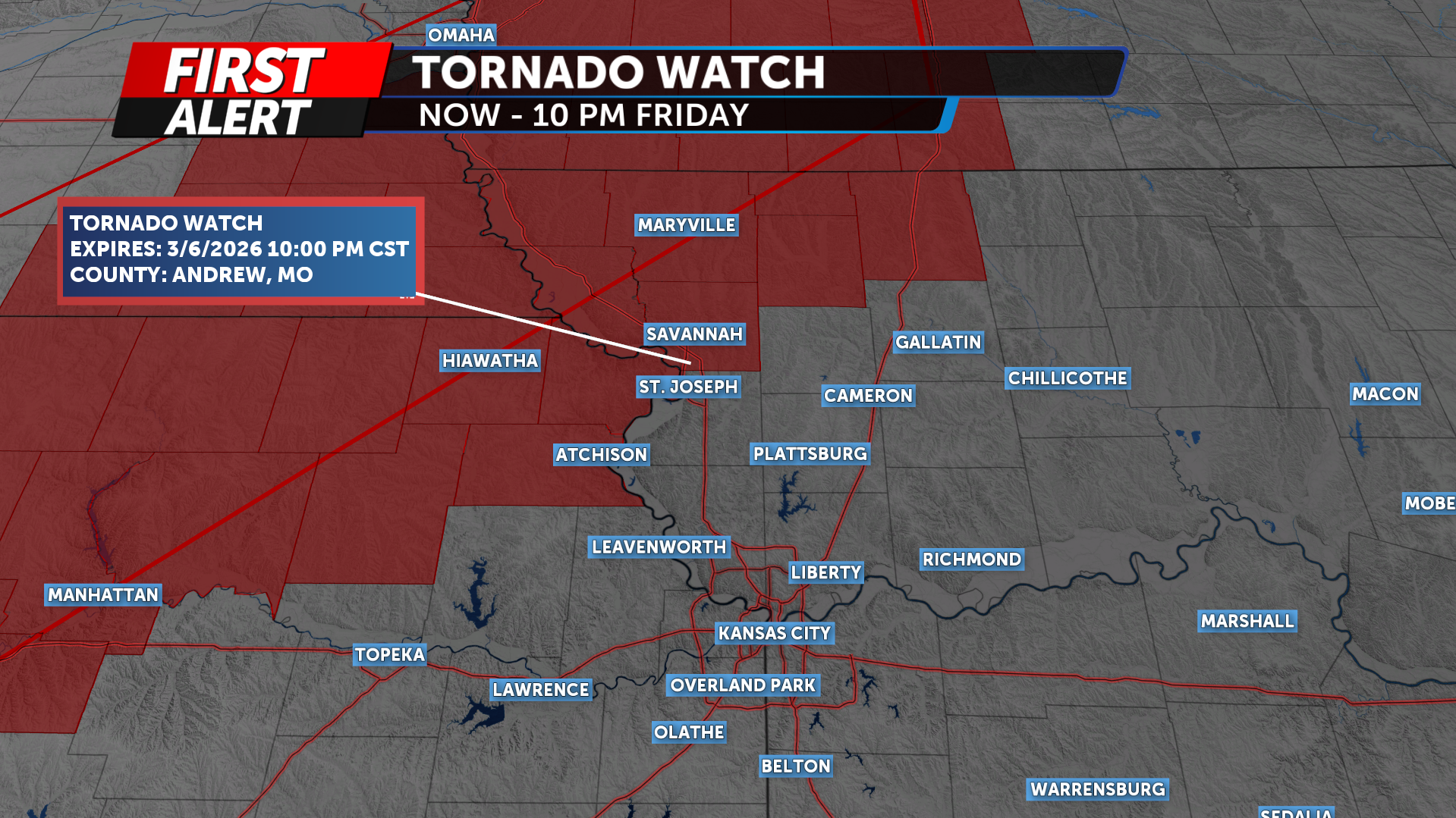
A Tornado Watch has been issued for parts of far Northwest Missouri and Northeast Kansas through 10 PM Friday.
A cold front will push across the region tonight, bringing the final round of strong storms before cooler and drier air move in after 2 AM Saturday. Highs on Saturday will only reach the low 50s. Temperatures rebound into the 60s by Sunday, and the weekend is expected to stay sunny and dry.
Rain chances return next week, with temperatures climbing back into the 70s.
